


Earthquakes
توضیحات Earthquakes
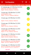
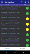
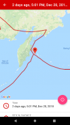
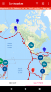
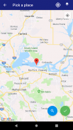
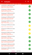
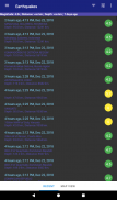
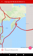
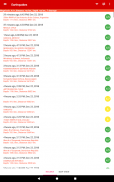
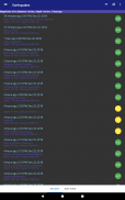
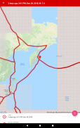
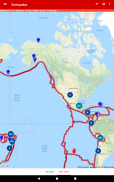
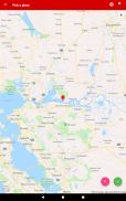
این اپلیکیشن موبایل برای کاربرانی طراحی شده است که علاقه مند به اطلاع از آخرین زلزله های سراسر جهان هستند. این برنامه دارای پایگاه داده ای از آخرین زمین لرزه ها است که می تواند در یک لیست و روی نقشه نمایش داده شود. نمای فهرست به کاربران امکان می دهد مکان، بزرگی و زمان هر زمین لرزه را ببینند، در حالی که نمای نقشه نمایشی بصری از مکان زلزله ارائه می دهد.
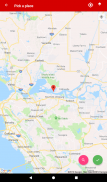
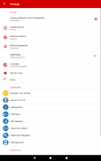
کاربران می توانند فهرست زمین لرزه ها را بر اساس قدرت، فاصله از مکان فعلی و عمق فیلتر کنند. این کار باعث میشود تا کاربران بتوانند زلزلههای مرتبط با آنها را پیدا کنند و ببینند که زلزلهها چقدر به مکان فعلیشان نزدیک هستند.
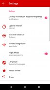
این برنامه همچنین دارای یک ویژگی هشدار است که کاربران را در مورد زلزله های جدید در زمان واقعی مطلع می کند. این ویژگی را می توان روشن یا خاموش کرد و کاربران می توانند انتخاب کنند که برای زلزله هایی با بزرگی خاص یا در فاصله معینی از مکان فعلی خود هشدار دریافت کنند.
چه دانشمند باشید، چه علاقهمند به زمینشناسی، یا فقط کسی که میخواهد از زلزلهها مطلع شود، این برنامه برای شما مناسب است.
این اپلیکیشن علاوه بر فهرست و نماهای نقشه، اطلاعات دقیقی درباره هر زمین لرزه شامل عمق، بزرگی و شدت آن نیز ارائه می دهد. کاربران همچنین می توانند به تاریخچه زمین لرزه های گذشته دسترسی داشته باشند که به آنها امکان می دهد فرکانس و توزیع زمین لرزه ها را در طول زمان ردیابی کنند.
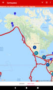
یکی دیگر از ویژگی های عالی هشدار زلزله، توانایی آن در نمایش زمین لرزه ها بر روی نقشه با استفاده از تصاویر ماهواره ای است. این کار نمایشی بصری از مکان زمین لرزه ها را در اختیار کاربران قرار می دهد و دیدن نزدیکی زمین لرزه ها به مناطق پرجمعیت را آسان می کند.
همچنین در این نقشه مرزهای صفحات تکتونیکی که در آنها زمین لرزه رخ می دهد نشان می دهد، می توان کشورها و مناطق خطرناک و امن کره زمین را ارزیابی کرد.
داده های مربوط به زمین لرزه ها از برنامه رسمی "USGS"، "برنامه لرزه نگاری اروپا" - "EMSC" و "سرویس GeoNet نیوزیلند" گرفته شده است.
Earthquakes - نسخه 3.4.40
(04-04-2025)Earthquakes - اطلاعات APK
نسخه APK: 3.4.40حزمة: com.kb.apps.earthquakesآخرین نسخه Earthquakes
سایر نسخهها


اپلیکیشنها در دسته مشابه


